Guests who walk the Hashikami section come back with the same follow-up question every time: what is on the other side of the border?
Kominato beach, where the Hashikami section ends, is the line between Aomori and Iwate. Step past the marker stone and you are in Hirono. The trail runs on from Kadonohama to Nakano — about 28km, by the town's own count.
Here is the short version. Of the three sections we send guests to, this is the easiest ground and the longest distance. There is nothing like the climb up Mt. Hashikami; instead there is 28km of near-flat paved road. And the JR Hachinohe Line stays beside you the entire way. So this article is not about fitness. It is about which station you get off at.
Past the border stone, you are in Iwate
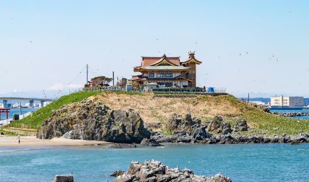
Hirono was formed in 2006 when the town of Taneichi and the village of Ono merged. The old Taneichi side faces the sea and the old Ono side is inland; the trail belongs to the Taneichi side. Coming from Hachinohe it feels less like entering a new place than like the coastline that started at Tanesashi simply carrying on across an administrative line.
Sanriku Fukko National Park continues south through Hachinohe, Hashikami and Hirono — the park does not stop at the prefectural border either. For where this sits in the whole route (Hachinohe in Aomori to Soma in Fukushima, 1,025km across 28 municipalities in four prefectures), see the Ministry of the Environment's official Michinoku Coastal Trail site.
One practical thing does change at the border: where the information comes from. For the Hachinohe and Hashikami sections you check an Aomori municipality's pages. From here on you are reading Iwate sources instead. Guests who do not realise this tend to get stuck at the planning stage rather than on the trail.
About 28km, and almost all of it is paved
The Hirono tourism association describes this as a roughly 28km course linking Kadonohama to Nakano. Published walkers' records put the stretch from Rikuchu-Nakano station to Kadonohama station at 24.5km, leaving before 7:30 in the morning and arriving a little after 2pm — call it around seven hours with breaks.
The contrast with Hashikami is stark. That section crosses Mt. Hashikami at 739.6m. This one, once you are inside Hirono, is almost entirely flat paved road. In terms of terrain it is the gentlest of the three.
Flat paved road over that distance tires you differently from a mountain, so three things are worth saying:
- Shoes — cushioned trainers you have already broken in beat hiking boots here. On hard surfaces the soles of your feet give out before your legs do
- Shade — the route links fishing ports and hamlets, and some stretches have very little of it. Carry more water and a hat than you would on the mountain
- Map — the route is signed, but the trail is designed around carrying the paper trail map. Hirono publishes its own section map
The town's map is available as a PDF on its Michinoku Coastal Trail and Sanriku Geopark section map page, and paper copies are handed out at facilities around town. For the full trail map set, check the Ministry of the Environment site above.
Cutting it into a day: three options, each ending at a station
The great advantage of this section is that the JR Hachinohe Line hugs the coast the whole way. The stations run Kadonohama, Hirauchi, Taneichi, Tamagawa, Shukunohe, Rikuchu-Yagi, Uge and Rikuchu-Nakano. In Hashikami, turning inland meant leaving the railway behind. Here, if you have had enough, you walk to the next station.
1. Kadonohama to Taneichi — starting at the border
This is what we suggest to guests who walked the Hashikami coast the day before. Get off at Kadonohama and you begin just south of the prefectural line, and before you reach the town of Taneichi you pass both of this section's real subjects: the sea urchin channels and the diving high school. It fits into a morning, which leaves the afternoon for Taneichi itself.
2. Taneichi to Rikuchu-Yagi — working harbours
Taneichi Beach Park, then Shukunohe fishing port: a run of harbours that are places of work rather than scenery. Walk it as such — keep clear of gear and of vehicles being loaded. Tamagawa and Shukunohe stations sit along the way if you want to stop early.
3. Rikuchu-Yagi to Rikuchu-Nakano — the quiet southern half
The run to the southern end, past Uge beach and the beach at Okonai, where the Seikokan site described below stands. To my eye this is the quietest stretch of the three sections. South of Rikuchu-Nakano you cross into Kuji and the trail keeps going.
Whichever you pick, the timetable decides your day. As on the other two sections: before you start walking, write down two possible trains home.
A town that cut 178 channels into the seabed
Two things are worth knowing before you walk here. They are really the same story told twice.
The first is the sea urchin channels, known locally as the uni ranch. In the late 1960s the fishermen of the time cut grooves into the shallow bedrock shelf — 178 of them, about 18km of channel in total. Seaweed drifting in from offshore collects in the grooves and becomes feeding ground for urchins. Nothing is released into the water; what was built was a landform that gathers food. At low tide you can make out the pattern of the channels from the shore.
The second is Nanbu-moguri, the local diving tradition. In 1898 the steamer Nagoya-maru ran aground off Taneichi. Divers came up from Boshu, in what is now Chiba, to salvage her, and their foreman Kotaro Mimura taught helmet diving to a local man, Sadakichi Isozaki. That is taken as the beginning. Taneichi had been territory of the Hachinohe domain — the Nanbu domain — which is where the name comes from.
The skill survived by being taught in a school. A diving course was established in 1952 and is today the marine development department of Iwate Prefectural Taneichi High School — the only course in Japan where students learn diving alongside civil engineering. The trail passes right by it.
Fishermen who carved the sea floor, and a town that kept diving alive by putting it on a timetable. Neither was built for visitors, so rather than hunting for interpretive signage, it is better to walk knowing that this is what kind of place you are in.
Okonai beach, and the inn Yanagita Kunio wrote about
If you walk the southern half, stop at the beach at Okonai. There was an inn here called Seikokan, where the folklorist Kunio Yanagita stayed in the Taisho era.
He returned to the same beach later and found the inn gone. What he wrote about that visit is the essay "Seikokan Aishi". A stone monument stands on the site, and in May 2025 local residents presented the town with rubbings taken from it. Read the piece first and an ordinary beach stops looking ordinary.
Along this stretch, beaches and hamlets alternate. Kumano shrine sits about 1.5km west of Rikuchu-Nakano station, and Okaya Inari shrine about 2km up the hillside from Shukunohe station. Neither is a tourist site; they are village shrines, and the right amount of attention is the amount you would give them passing by.
Getting there, and getting back
Hachinohe station to Taneichi station is roughly an hour on the JR Hachinohe Line. It is not a frequent line. Reckon on one train every one to two hours during the day. Arrive at a station with a city rhythm in your head and you will be sitting there for an hour.
- Out — take the Hachinohe Line from Hachinohe station. You can connect straight off the Shinkansen, but an hour's wait for the connection is entirely normal
- Stations to stop at — Kadonohama, Hirauchi, Taneichi, Tamagawa, Shukunohe, Rikuchu-Yagi, Uge, Rikuchu-Nakano. All of them get you back towards Hachinohe
- Back — check current times on the JR East timetable. Note two candidate trains before you set off
- Car — a rental gives you freedom, but walking a section one way leaves your car at the wrong end. This section suits the train
Taneichi station marked its 100th anniversary in 2024. That the railway has run along this coast for a century is exactly why the section is as walkable as it is. On choosing between Hachinohe and Hon-Hachinohe stations, see the station article; for getting around from Hachinohe generally, the access page.
Where to stop, and what to eat
The natural base along the way is Hirono Suisan Kaikan, called "Unique". It is a white, ship-shaped building raised on the site of the old Taneichi Furusato Bussankan, the local produce hall the 2011 tsunami destroyed completely. The ground floor is a seafood market, the third floor has a light-meal counter and a local produce display, and the observation deck looks out over the Pacific, Taneichi Beach Park and the hatchery where urchin seed is raised. The height the tsunami reached is marked on the third floor.
Opening hours are 9:00–17:00 from 1 April to 30 September and 9:00–16:00 from 1 October to 31 March, closed Thursdays and from 29 December to 6 January (as of 2026). These change, so check the town's Hirono Suisan Kaikan Unique page before you go.
Hirono also runs something called Hirono Trail Angel: local businesses that will let walkers use a toilet, refill water, or point them back onto the route. Around sixteen places along the course take part, and which ones is listed on the tourism association's Michinoku Coastal Trail page. Convenience stores are thin on the ground here, so read that list before you walk rather than after.
Taneichi Beach Park faces a sand beach and has a campsite. The swimming season usually runs from mid-July to mid-August — which is not when you will be walking, so in autumn it is simply a quiet place to sit down.
Walk in autumn, come back for the urchins in early summer
It is only fair to say this plainly: the best season to walk this section and the season for Hirono's urchins do not coincide.
The fresh uni fishery runs from early May to early July, and the eating season from June through August. The Taneichi Uni Festival is held at Taneichi Beach Park in summer; in 2025 it fell on 13 July. Walking, meanwhile, is best from September to November, once the heat has gone and before the wind gets serious.
Early June is the one point where the two overlap, but the days are long then and heat comes back off the tarmac. What I tell guests is that walking here and eating here are better planned as two separate trips. Walk in autumn, see the channels, and come back when the urchins are in.
In winter, the problems are wind and daylight. A paved coastal road offers nowhere to shelter, so bring one more layer than you think. For what is in season on the Hachinohe side, see the mackerel and squid article.
Using Nvillage as a base
There is not much accommodation aimed at walkers in Hirono, so the realistic approach is to stay near Hachinohe station, where the Hachinohe Line starts, and go out and back each day. Nvillage is a 10–12 minute walk from the west exit, with smart-lock self check-in, so a late train back is not a problem.
For guests walking the trail section by section from the north, we suggest three nights: the Hachinohe section, then Hashikami, then Hirono. One section a day means none of them gets rushed. Being able to put three days of walking clothes through the washer and dryer the same evening, and to get your legs back in the barrel sauna (paid, by reservation), is what makes the second and third mornings possible.
For days you are not walking, the area guide and our experiences with local makers cover the alternatives. For room availability, or advice on which section to start with, write to us through the contact page — dates do not need to be fixed yet. We will look at the timetable and the forecast with you.